NWS: Critical Fire Conditions & Winter Storm for New Years

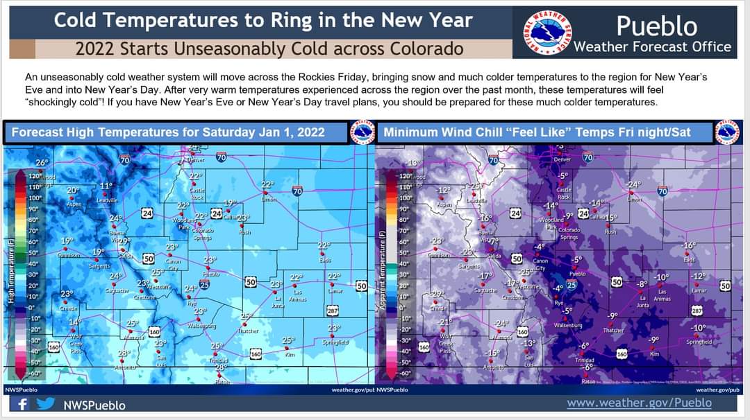
Description: Unseasonably cold temperatures forecast for New Years Eve in Southeast Colorado. (Image provided by the National Weather Service Office of Pueblo)

NWS: Critical Fire Conditions & Winter Storm for New Years
Crowley County-La Junta Vicinity/Otero County- Eastern Las Animas County-Western Kiowa County- Eastern Kiowa County-Las Animas Vicinity/Bent County- Lamar Vicinity/Prowers County-Springfield Vicinity/Baca County- 444 AM MST Wed Dec 29 2021
This hazardous weather outlook is for portions of central...east central...south central and southeast Colorado. .
DAY ONE...Today and Tonight Heavier mountain snowfall will slowly wind down today. Enhanced to locally critical fire weather conditions are expected across the plains this afternoon. .
DAYS TWO THROUGH SEVEN...Thursday through Tuesday Heavier mountain snows, Continental Divide and southwest mountains, commences early Thursday morning and continues through Saturday morning.
A light accumulation is also possible late Friday night into Saturday morning along the I-25 corridor and points east. Elevated to locally critical fire weather conditions expected Thursday and Friday over the plains.
.SPOTTER INFORMATION STATEMENT... Weather conditions that meet reporting criteria for spotters will be likely across the Continental Divide through this morning.
Follow SECO Weather on Facebook.
Follow SECO News on Facebook.
Subscribe to the SECO News YouTube Channel.
SECO Weather Sponsor
.png)


.png)


.png)


.png)


.png)


.png)


