Aspen Acres Fire Reaches 100,756 Acres as Crews Strengthen Lines Near Rye and San Isabel
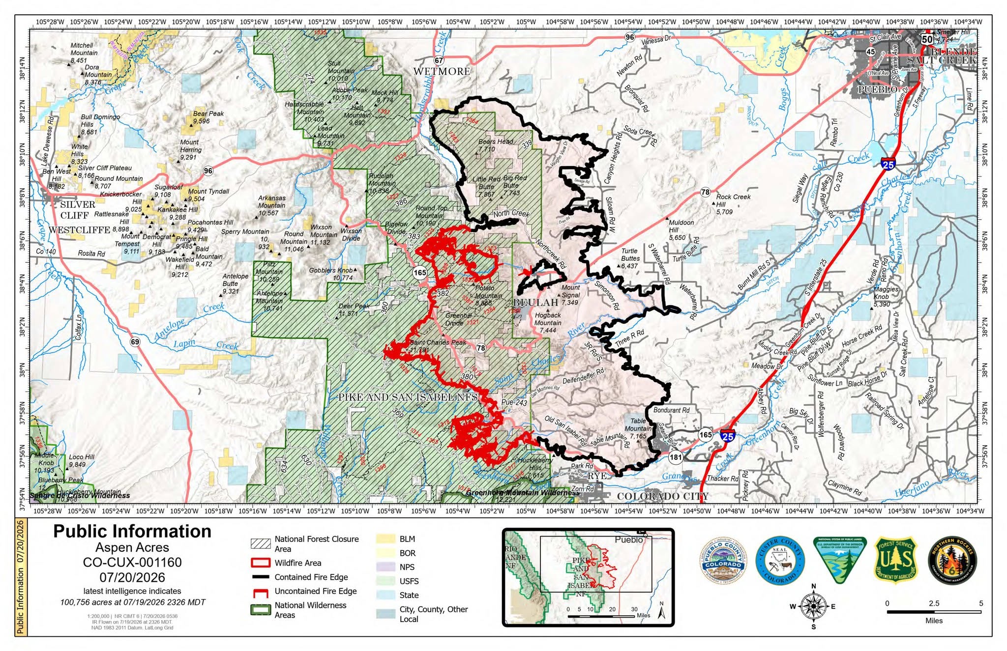
Description: The Aspen Acres Fire remains 61% contained at 100,756 acres as crews reinforce western firelines, support re-entry in Custer County and prepare for near-critical fire weather...
Published: 07/20/2026
Byline: SECO News

Aspen Acres Fire Daily Update
Fire Information 719-697-8353
Email: 2026.aspenacres@firenet.gov
July 20, 2026
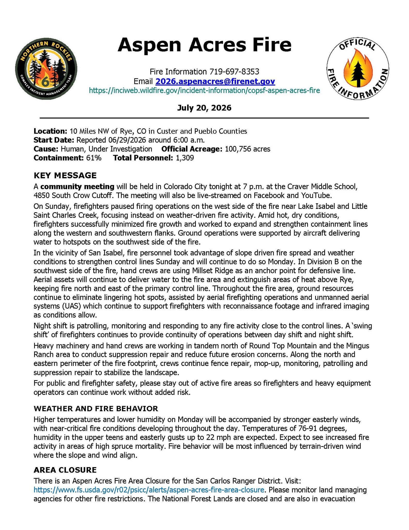
Location: 10 Miles NW of Rye, CO in Custer and Pueblo Counties
Start Date: Reported 06/29/2026 around 6:00 a.m.
Cause: Human, Under Investigation Official Acreage: 100,756 acres
Containment: 61% Total Personnel: 1,309
KEY MESSAGE
A community meeting will be held in Colorado City tonight at 7 p.m. at the Craver Middle School, 4850 South Crow Cutoff. The meeting will also be live-streamed on Facebook and YouTube.
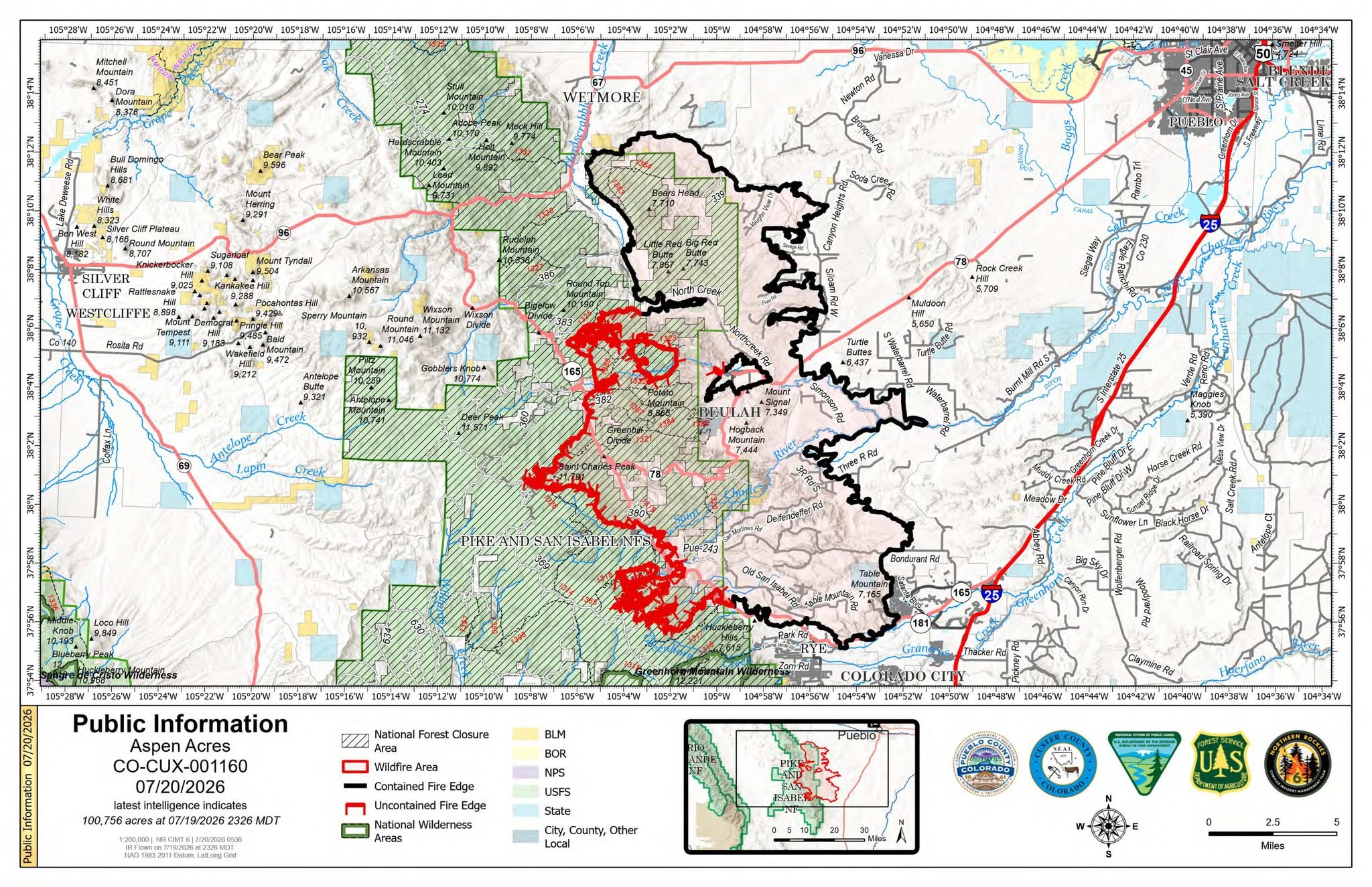
On Sunday, firefighters paused firing operations on the west side of the fire near Lake Isabel and Little Saint Charles Creek, focusing instead on weather-driven fire activity. Amid hot, dry conditions, firefighters successfully minimized fire growth and worked to expand and strengthen containment lines along the western and southwestern flanks. Ground operations were supported by aircraft delivering water to hotspots on the southwest side of the fire.
In the vicinity of San Isabel, fire personnel took advantage of slope driven fire spread and weather conditions to strengthen control lines Sunday and will continue to do so Monday. In Division B on the southwest side of the fire, hand crews are using Millset Ridge as an anchor point for defensive line. Aerial assets will continue to deliver water to the fire area and extinguish areas of heat above Rye, keeping fire north and east of the primary control line. Throughout the fire area, ground resources continue to eliminate lingering hot spots, assisted by aerial firefighting operations and unmanned aerial systems (UAS) which continue to support firefighters with reconnaissance footage and infrared imaging as conditions allow.
Night shift is patrolling, monitoring and responding to any fire activity close to the control lines. A ‘swing shift’ of firefighters continues to provide continuity of operations between day shift and night shift.
Heavy machinery and hand crews are working in tandem north of Round Top Mountain and the Mingus Ranch area to conduct suppression repair and reduce future erosion concerns. Along the north and eastern perimeter of the fire footprint, crews continue fence repair, mop-up, monitoring, patrolling and suppression repair to stabilize the landscape.
For public and firefighter safety, please stay out of active fire areas so firefighters and heavy equipment operators can continue work without added risk.
WEATHER AND FIRE BEHAVIOR
Higher temperatures and lower humidity on Monday will be accompanied by stronger easterly winds, with near-critical fire conditions developing throughout the day. Temperatures of 76-91 degrees, humidity in the upper teens and easterly gusts up to 22 mph are expected. Expect to see increased fire activity in areas of high spruce mortality. Fire behavior will be most influenced by terrain-driven wind where the slope and wind align.
AREA CLOSURE
There is an Aspen Acres Fire Area Closure for the San Carlos Ranger District. Visit: https://www.fs.usda.gov/.../aspen-acres-fire-area-closure. Please monitor land managing agencies for other fire restrictions. The National Forest Lands are closed and are also in evacuation status. There is a Temporary Flight Restriction (TFR) in place above the fire area. Flying any aircraft within the TFR is prohibited. This includes the use of drones, or unmanned aerial systems.
EVACUATIONS
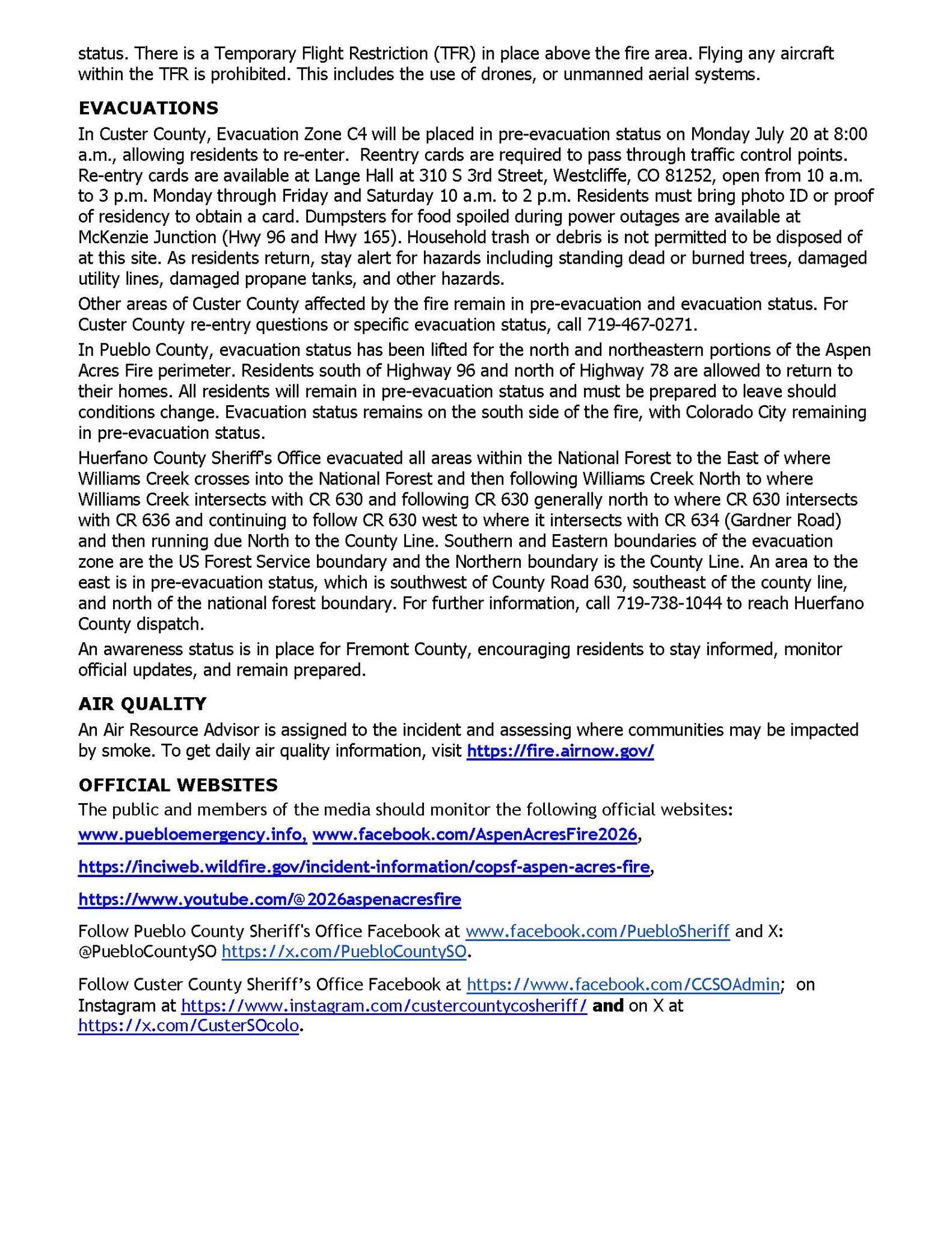
In Custer County, Evacuation Zone C4 will be placed in pre-evacuation status on Monday July 20 at 8:00 a.m., allowing residents to re-enter. Reentry cards are required to pass through traffic control points. Re-entry cards are available at Lange Hall at 310 S 3rd Street, Westcliffe, CO 81252, open from 10 a.m. to 3 p.m. Monday through Friday and Saturday 10 a.m. to 2 p.m. Residents must bring photo ID or proof of residency to obtain a card. Dumpsters for food spoiled during power outages are available at McKenzie Junction (Hwy 96 and Hwy 165). Household trash or debris is not permitted to be disposed of at this site. As residents return, stay alert for hazards including standing dead or burned trees, damaged utility lines, damaged propane tanks, and other hazards.
Other areas of Custer County affected by the fire remain in pre-evacuation and evacuation status. For Custer County re-entry questions or specific evacuation status, call 719-467-0271.
In Pueblo County, evacuation status has been lifted for the north and northeastern portions of the Aspen Acres Fire perimeter. Residents south of Highway 96 and north of Highway 78 are allowed to return to their homes. All residents will remain in pre-evacuation status and must be prepared to leave should conditions change. Evacuation status remains on the south side of the fire, with Colorado City remaining in pre-evacuation status.
Huerfano County Sheriff's Office evacuated all areas within the National Forest to the East of where Williams Creek crosses into the National Forest and then following Williams Creek North to where Williams Creek intersects with CR 630 and following CR 630 generally north to where CR 630 intersects with CR 636 and continuing to follow CR 630 west to where it intersects with CR 634 (Gardner Road) and then running due North to the County Line. Southern and Eastern boundaries of the evacuation zone are the US Forest Service boundary and the Northern boundary is the County Line. An area to the east is in pre-evacuation status, which is southwest of County Road 630, southeast of the county line, and north of the national forest boundary. For further information, call 719-738-1044 to reach Huerfano County dispatch.
An awareness status is in place for Fremont County, encouraging residents to stay informed, monitor official updates, and remain prepared.
AIR QUALITY
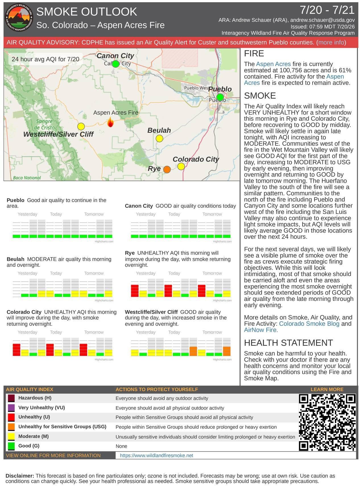
An Air Resource Advisor is assigned to the incident and assessing where communities may be impacted by smoke. To get daily air quality information, visit https://fire.airnow.gov/
OFFICIAL WEBSITES
The public and members of the media should monitor the following official websites:
Follow Pueblo County Sheriff's Office Facebook at www.facebook.com/PuebloSheriff
and X: @PuebloCountySO https://x.com/PuebloCountySO.
Follow Custer County Sheriff’s Office Facebook at https://www.facebook.com/CCSOAdmin;
on Instagram at https://www.instagram.com/custercountycosheriff/
and on X at https://x.com/CusterSOcolo.
Follow SECO News on Facebook.
Subscribe to the SECO News YouTube Channel.
Click to Zoom
Press releases Sponsor




.jpg)


.png)

.png)











.png)