Gold Mountain Fire BAER Team Evaluates Soil Burn Severity and Post-Fire Flood Risks
Description: The Gold Mountain Fire BAER Team is mapping soil burn severity to assess post-fire flooding, debris-flow, erosion and runoff risks and guide recovery planning...
Published: 08/12/2026
Byline: SECO News

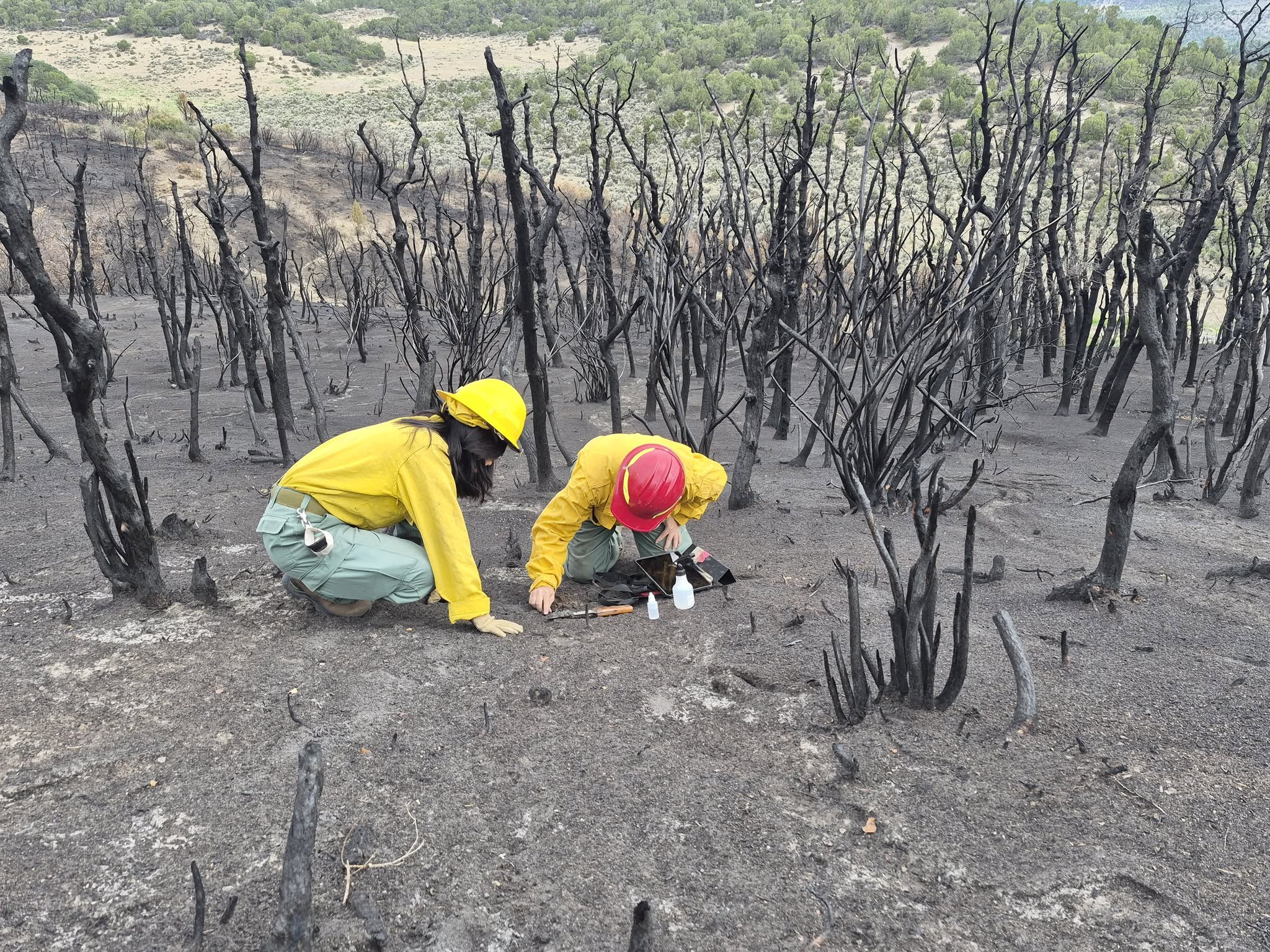
The Burned Area Emergency Response, or BAER Team, has been evaluating the burned landscape and developing Soil Burn Severity findings for the #GoldMountainFire.
Using satellite imagery along with observations on the ground, specialists evaluate how the fire affected the soil and classify areas from unburned/very low to low, moderate, or high soil burn severity.
Why does that matter?
Soil burn severity helps specialists understand how the landscape may respond when rain falls on the burn scar. Areas with greater impacts can have increased potential for runoff, erosion, sediment movement, flooding, and debris flows.
The findings are then used to help:
- Identify areas where post-fire hazards may have increased
- Evaluate risks to life, property, roads, watersheds, and other critical resources
- Support modeling of potential flooding and debris-flow hazards
- Prioritize areas that may need emergency stabilization or other treatments
- Provide information to land managers, emergency managers, counties, and other partners for post-fire planning
The work doesn't end when the flames are gone. Understanding how the landscape changed is an important part of preparing communities for the next rainstorm and the months and years of recovery ahead.
Photos of BAER team members working on the Gold Mountain Fire and their Soil Burn Severity report, courtesy of the Gold Mountain Fire.
Follow SECO News on Facebook.
Subscribe to the SECO News YouTube Channel.
Press releases Sponsor




.jpg)


.png)

.png)









.png)