Aspen Acres Fire Grows to 93,634 Acres; Crews Strengthen Lines Near Greenwood and Wetmore
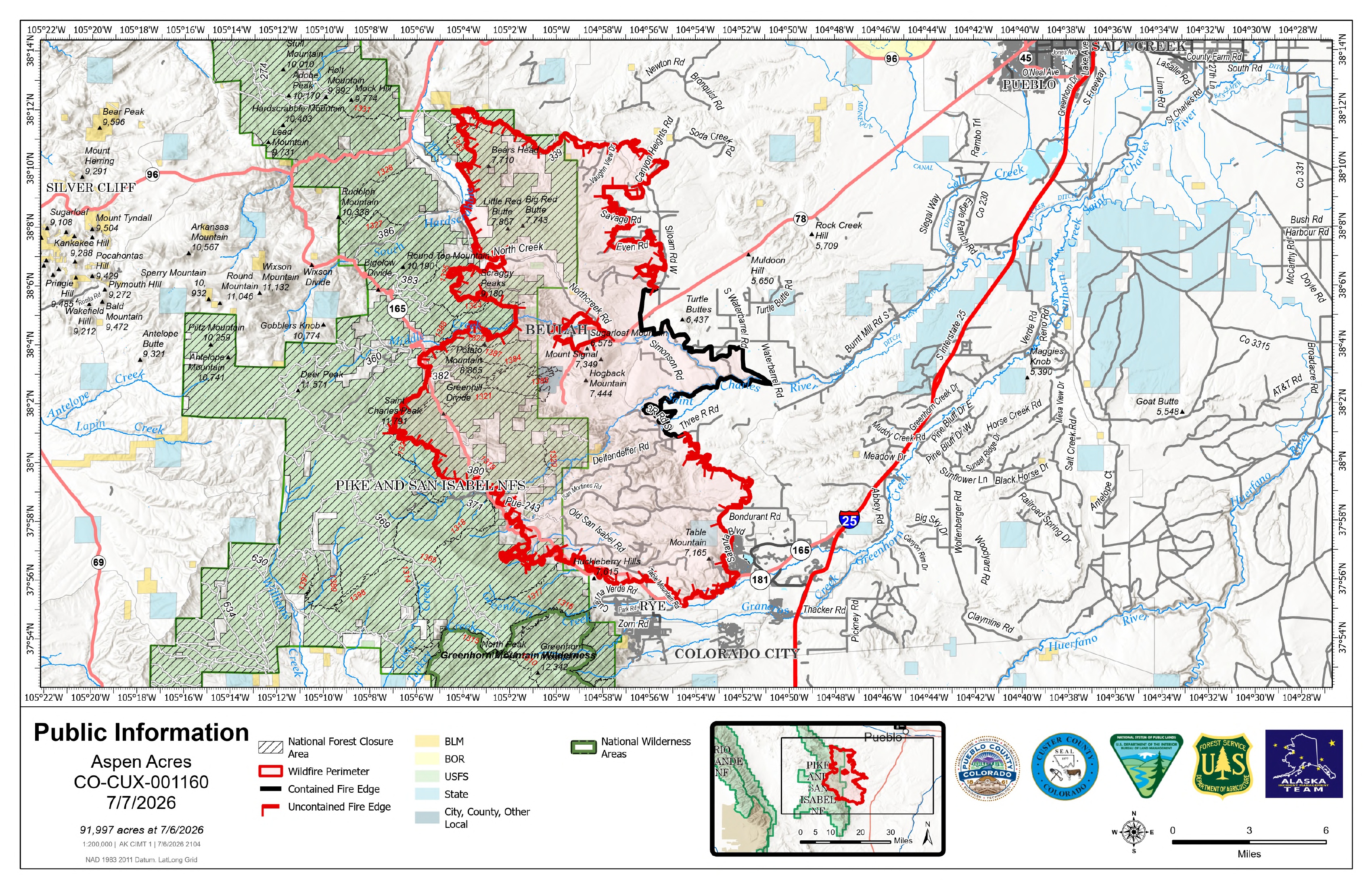
Description: The Aspen Acres Fire is now 93,634 acres and 15% contained near Rye, Colorado. Firefighters are reinforcing firelines near Greenwood, Wetmore, South Hardscrabble Creek, Highway 165, Rye, and Siloam Road as storms bring possible 50 mph wind gusts and flash flooding.

Aspen Acres Fire Update
Tuesday, July 7, 2026 – 8:00 a.m.
Alaska Complex Incident Management Team 1
Jake Livingston, Incident Commander
Size: 93,634 | Containment: 15% | Total Personnel: Approximately 1,562
Location: 10 Miles NW of Rye, CO in Custer and Pueblo Counties
Reported: June 29, 2026, at 6:00 a.m. | Cause: Human, Under Investigation
Fire Information Phone Line: 719.697.8353 | Email: 2026.aspenacres@firenet.gov
Fire Update: Firefighters have completed a multi-shift effort to construct an extensive fireline designed to defend the communities of Greenwood and Wetmore. The fire made a significant push towards those communities on Sunday night. Crews connected a combination of dozer line and handline to accomplish this mission. Tuesday they're working to improve those lines and make sure they are ready for potential firing operations, if needed, to protect Greenwood and Wetmore from fire impact.
Also on the northwest edge, outflow winds from by passing storms on Monday pushed fire down into South Hardscrabble Creek drainage, about one mile west of Little Red Butte. Firefighters took actions to protect structures in the area, and work continues to try and keep the fire from crossing the creek. Fire activity also increased near the Lefthand Fork of North Creek Monday afternoon, pushing westward towards Colorado Highway 165. Crews have begun structure protection in the area, and they are preparing to engage the fire if it continues to push towards the highway.
Firefighters continue to patrol the Aspen Acres and San Isabel areas, checking for hot spots and securing the lines. On the southern edge, hotshot crews are directly engaging a section of fire south of Highway 165, west of Rye. They are working to slow fire progression and establish new line to keep the fire from impacting Rye. The rest of the southern edge from Rye to Colorado City is looking secure. Crews have been methodically working to extinguish hotspots and deepen the line.
While much of the fire's eastern edge is either contained or in mop-up status, firefighters have been heavily focused on flareups in the northeast corner along Siloam Road where it meets Even Road, all the way up to Canyon Heights. The fire was active in that area yesterday, and crews took actions to protect structures and secure the line.
Weather: A line of showers and thunderstorms is moving in Tuesday, which could bring more significant precipitation accumulation than we've seen over the last week. Outflow winds from storms could push wind gusts up to 50 mph over the fire area. There is also the potential for flash flooding.
Fire Behavior: Fuels remain historically dry and conducive to fast ignitions and fire spread. Tuesday's cloud cover and expected precipitation should moderate fire activity.
Fire Restrictions & Closures: Stage 2 Fire Restrictions are in effect in Custer and Pueblo Counties, as well as on the Pike-San Isabel National Forests & Cimarron and Comanche National Grasslands. There is an Aspen Acres Fire Area Closure for the San Carlos Ranger District. Visit: https://www.fs.usda.gov/r02/psicc/alerts/aspen-acres-fire-area-closure
Evacuations: Evacuations and pre-evacuations are in place across Custer, Pueblo, Fremont, and Huerfano Counties. Please call the Joint Information Center (JIC) at 719-583-4640 for information about closures, evacuations, Disaster Assistance Center (DAC) information, and more for Pueblo and Custer Counties. Huerfano and Fremont County residents should visit their county's social media pages or call 719-738-1044 for Huerfano County dispatch and 719-276-7421 for the Fremont County Emergency Operations Center.
There is a Temporary Flight Restriction (TFR) in place above the fire area. Flying any aircraft within the TFR is prohibited. This includes the use of drones, or unmanned aerial systems.
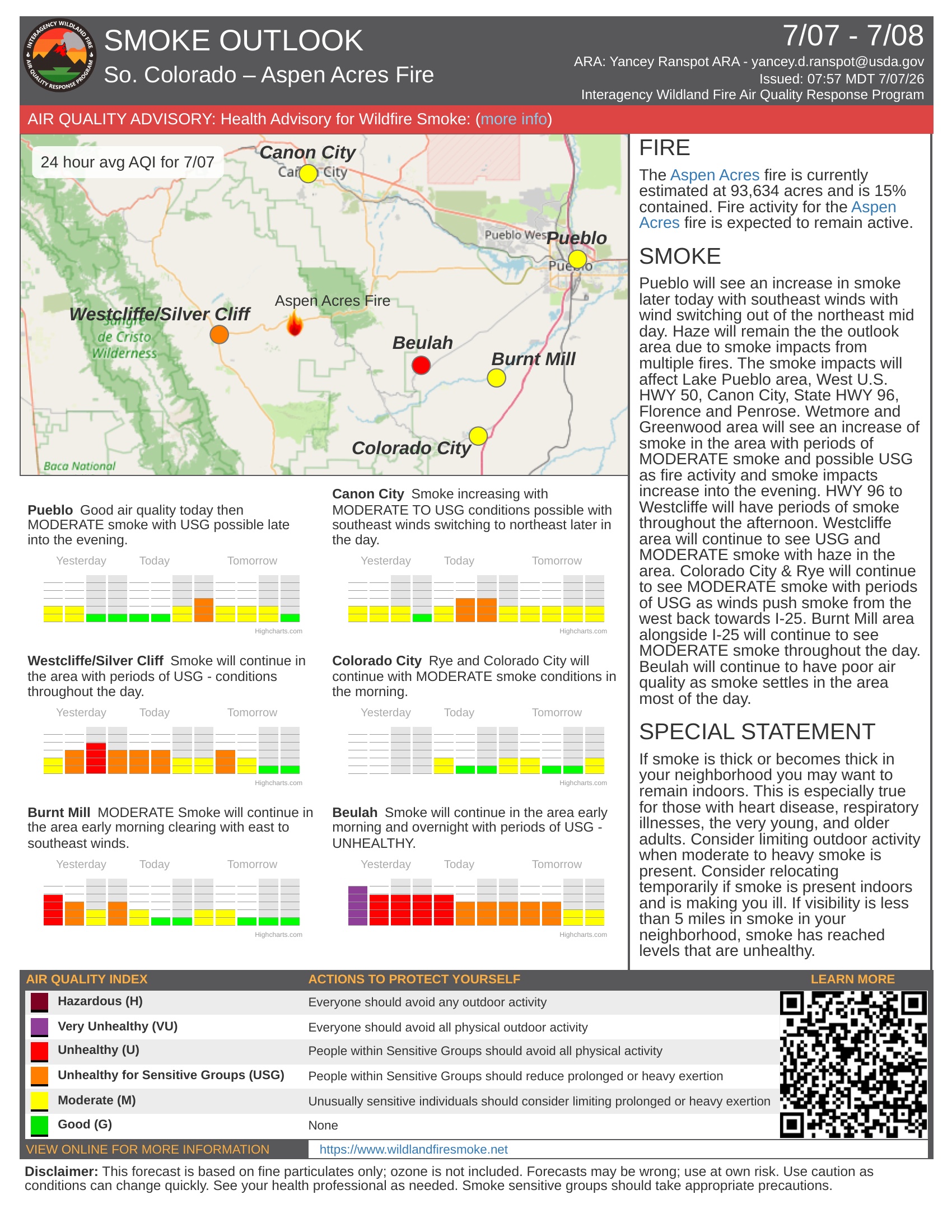
Air Quality: An Air Resource Advisor is assigned to the incident and assessing where communities may be impacted by smoke. To get daily air quality information, visit https://fire.airnow.gov/
Related Content
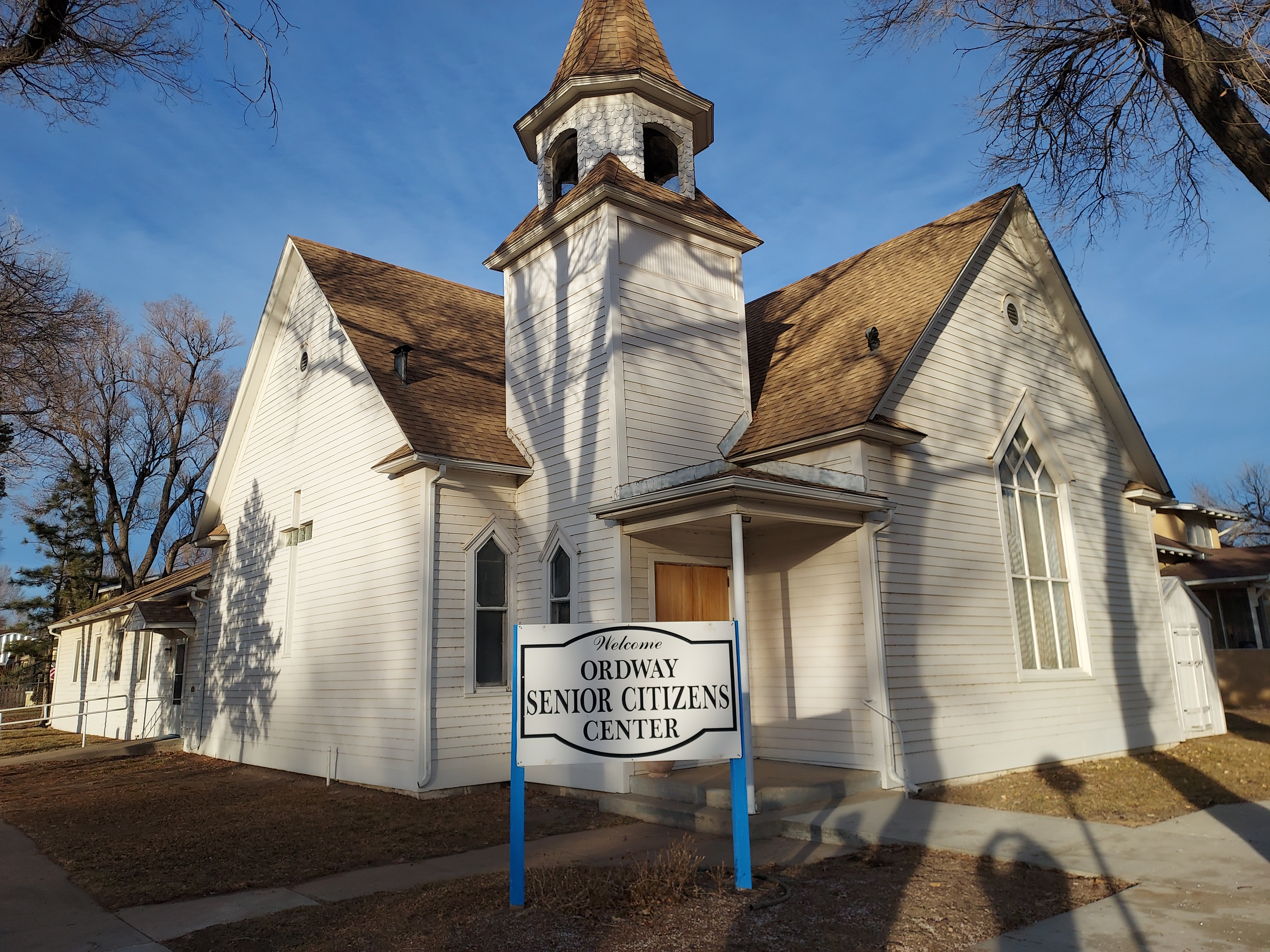 Ordway Donation Drive Collecting Supplies for Colorado Wildfire Victims Through Aug. 1
Follow SECO News on Facebook.
Subscribe to the SECO News YouTube Channel.
Click to Zoom
Press releases Sponsor




.jpg)


.png)

.png)










.png)