Ferris Fire Reaches 63,271 Acres as Extreme Heat, Low Humidity and Strong Winds Challenge Crews
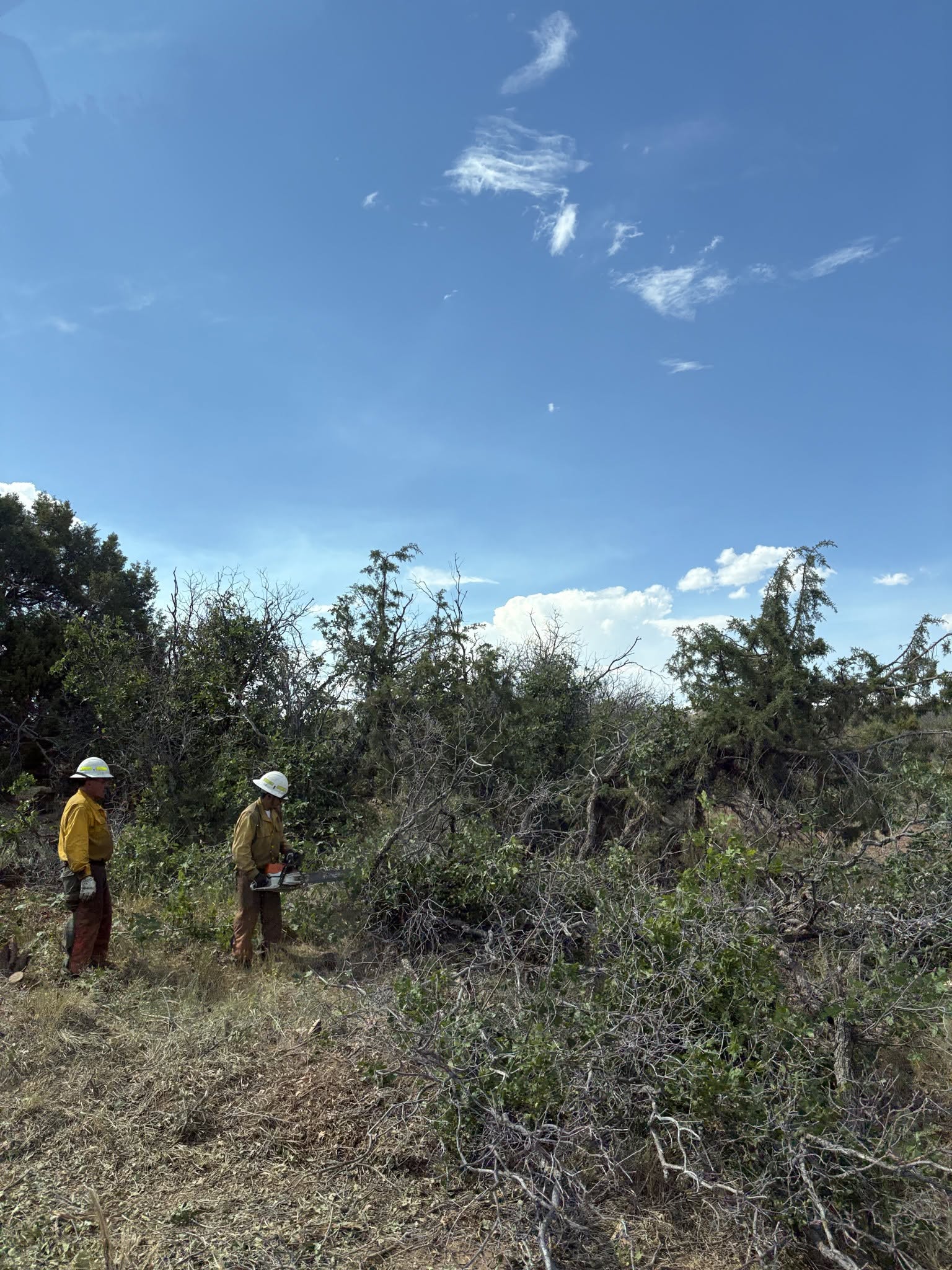
Description: The Ferris Fire reached 63,271 acres and remains 19% contained as crews strengthen lines near Dolores Canyon amid extreme heat, low humidity and gusty winds...
Published: 07/11/2026
Byline: SECO News

Ferris Fire Update
Saturday, July 11, 2026
Email: 2026.ferris@firenet.gov
Phone: 661-990-4727
Acres: 63,271 Containment: 19% | Reported: 06/27/2026
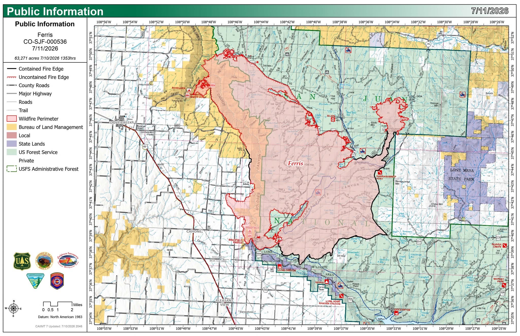
Most of the fire activity Friday occurred in and around Dolores Canyon, to the north and west of Dolores Canyon Overlook. While the fire grew slightly, it remained on the eastern side of Dolores River around Box Elder Campground and is still within the planned primary control lines.
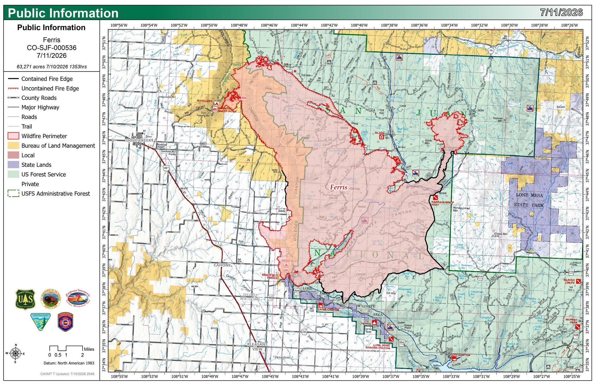
Firefighters continued to build and improve indirect control lines along the Rim of Dolores Canyon. These lines were reinforced with retardant drops from both fixed-wing aircraft and helicopters throughout the day. A mobile retardant base was established at Dove Creek Airport to better support ground operations. Overnight, crews patrolled this area, improved lines, and conducted tactical firing operations to remove available fuels and help keep the fire within established control lines.
On the northeastern portion of the fire, hotshot crews and heavy equipment operators continued constructing direct fireline from Benchmark Lookout north to Willow Draw. Around the remainder of the fire perimeter, crews continued to mop-up, improve and patrol control lines to strengthen containment and limit the potential for fire spread.
Evacuation Zones 1, 2, and 10, 14a and 14b are all in “GO” status.
Zones 3, 5, 7, 8, 9, 12, 13 and 16 are all in “SET” status.
Visit the Dolores County interactive evacuation map for your zone.
Today’s Operations: Hotshot crews and heavy equipment operators will continue constructing and improving primary strategic control lines along the edge of Dolores Canyon. These lines will be reinforced with retardant drops from aircraft. Crews may conduct strategic firing operations when conditions warrant to reduce available fuels, limit fire spread and support long-term containment objectives.
A crew will begin scouting the area north of Dolores County Road B on the west side of Dolores Canyon and north of the San Juan National Forest boundary on the east side of the canyon to identify potential contingency lines. While there is a strong plan in place for current operations, contingency lines allow firefighters to quickly shift operations and continue slowing or stopping fire spread if the fire moves beyond the primary control lines.
On the northeastern side of the fire, near Benchmark Lookout, crews will continue constructing direct control lines. Around the remainder of the fire perimeter, firefighters will patrol existing lines, extinguishing remaining hot spots and strengthening the lines where needed to ensure they remain secure.
Weather: Another hot, dry day is in store for the region. Record high temperatures are expected to be between 90 and 100 degrees. Relative humidity values will fall into single digits by Saturday afternoon. Winds will be out of the west to northwest gusting to 25 mph. A stronger period of southeast wind is expected Saturday night, with potential gusts near 40 miles per hour. Sunday will be hot once again with isolated showers and storms developing by afternoon. Gusty, erratic winds and lightning are possible with these storms.
Personnel: 846 personnel are assigned to the Ferris fire.
Evacuations and Closures: Both Dolores and Montezuma Counties have active evacuation orders in place. An interactive evacuation map is available at: http://tinyurl.com/FerrisFireEvacMap. For current information see the Dolores County Office of Emergency Management Facebook page. The San Juan National Forest has a Fire Area Closure in place as does the Bureau of Land Management for Bridge Recreation Area and multiple roads on the north end of the Ferris Fire.
NO DRONE ZONE: Private aircraft, including drones, are not allowed over the fire or McPhee Reservoir. A Temporary Flight Restriction (TFR) is in effect over the fire area.
Smoke Information: Continued hot temperatures, low humidity, and high mixing heights, compounded with active fire behavior and burnout operations, are likely to continue producing smoke aloft throughout the day. Smoke production will likely be isolated to the active fire operations in Big Spring Gulch, Glade Canyon and around Delores Canyon Overlook. In spite of visible smoke, near-ground air quality is expected to remain GOOD overnight and into the morning in locations near the Ferris Fire.
Follow SECO News on Facebook.
Subscribe to the SECO News YouTube Channel.
Click to Zoom

Press releases Sponsor




.jpg)


.png)

.png)










.png)